- Home
- >
- Preservation Archaeology Blog
- >
- Survey Says…
Adam Sezate, Graduate of United States Naval Academy

(June 8, 2016)–Under our survey supervisor, Evan Giomi, my partners and I had the opportunity to help the Nature Conservancy survey their land along the Gila River. My team and I were in search of any clues of past human settlement in an area several miles upriver from the Gila River Farm.
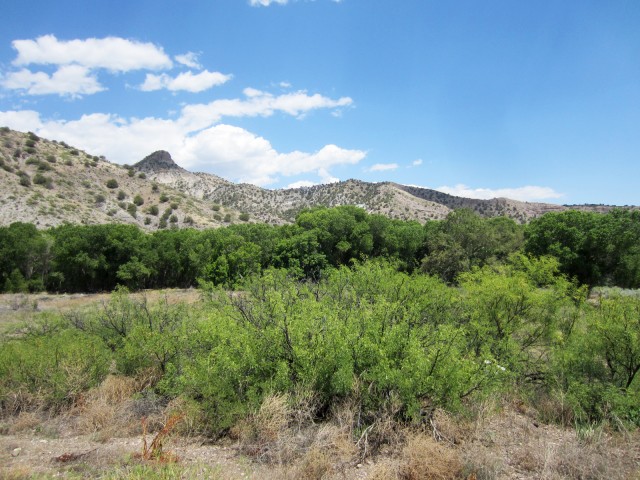
Our first day of survey began on a bench (geological terrace above a river or stream) overlooking the river. From our vantage point at the start of our first survey location, we could only manage to see the treetops of cottonwood trees snaking their way through the valley and disappearing around a sharp bend in the distance. (For those not familiar with archaeological surveys, they are reminiscent of search parties—or “FOD walkdowns,” for all my fellow military veterans out there reading this blog.)
We walked a straight line and systemically searched for artifacts on the surface. Unfortunately for us, dense mesquite brush with spines the size of carpenter nails and tortuous ravines and washes turned our perfect search lines into zigzags, squiggles, and everything in between. Despite all this, we stumbled upon a high density of stone flakes accompanied by various stone tools and plain brown ware ceramics. Based on our initial analysis, and due to the lack of decorated pottery, we determined the site may date to the Mogollon Early Pithouse period. Like good surveyors and aspiring archaeologists, we documented the site and moved on to our second location further upriver.
Our second location turned out to be slightly more exciting. The team and I walked through the Gila floodplain to arrive at the Nature Conservancy property near the Box Canyon campground. The hike along the river was pleasant under the canopy of cottonwoods. The ground was soft sandy silt that cushioned every step. The cool wind rustled the leaves to provide a melancholy, relaxed experience.
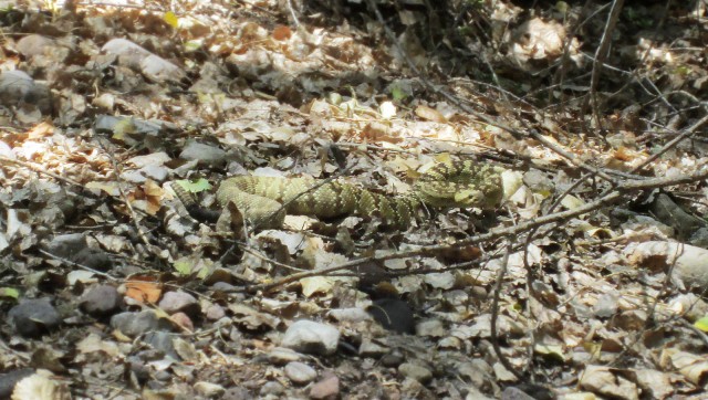
In my euphoria I looked up just in time to see Evan jump five feet in the air attempting to evade a Mohave rattlesnake several feet in front us! Despite the terrifying rattle and menacing hiss, the creature was actually quite beautiful. We gave it its space and arrived at our survey start point on a small knoll by the floodplain.

Once again, we intended on walking our transects (search lines), but instantly encountered several lithic artifacts and two identifiable sherds, quickly meeting the criteria for the area to be labeled as a site. Based on the design of the sherds we found, we interpreted it as possible Pithouse phase. We also found several plain sherds in conjunction with decorated pieces. Historic artifacts were littered throughout site, leading us to believe it could have been a trash dump at some point. Contemporary masonry, pre-WW I glass, and historic metal were found throughout. Unfortunately, we ran out of time the first day and returned the next day to complete our documentation.
Once we thought we had this site figured out, I reached under a mesquite brush to find a beautiful Salado sherd and plenty of corrugated pottery in the immediate vicinity. The Salado sherd alone expanded our tidy timeline by 500 years. Two days of survey yielded great information about the area.
Survey says…two more sites to add to the archaeological record!

Explore the News
-
Join Today
Keep up with the latest discoveries in southwestern archaeology. Join today, and receive Archaeology Southwest Magazine, among other member benefits.