- Home
- >
- Preservation Archaeology Blog
- >
- A Day in the Great Bend of the Gila
(November 20, 2024)—Many readers will likely be aware of the Respect Great Bend national monument campaign and coalition, which involves 13 organizations and which Archaeology Southwest helps lead. The coalition works together to advocate for the protection of the “Great Bend of the Gila,” a region of the Sonoran Desert in southwestern Arizona named for a dramatic curve in the Gila River near the town of Gila Bend. This area is mostly undeveloped Sonoran Desert that is today public land managed by the Bureau of Land Management. This hasn’t always been the case.
The Great Bend of the Gila has been home to Indigenous Peoples for thousands of years and has long served as an important travel corridor for people crossing the Sonoran Desert. Many parts of this landscape are considered sacred and holy places by today’s Tribal Nations. This includes the Yavapai, one of Arizona’s Indigenous communities represented today by the Yavapai-Prescott Indian Tribe (YPIT), Fort McDowell Yavapai Nation (FMYN), and Yavapai-Apache Nation (YAN). YPIT is located adjacent to the city of Prescott, YAN near Camp Verde, and FMYN in the northeastern outskirts of the Phoenix Metropolitan Area.
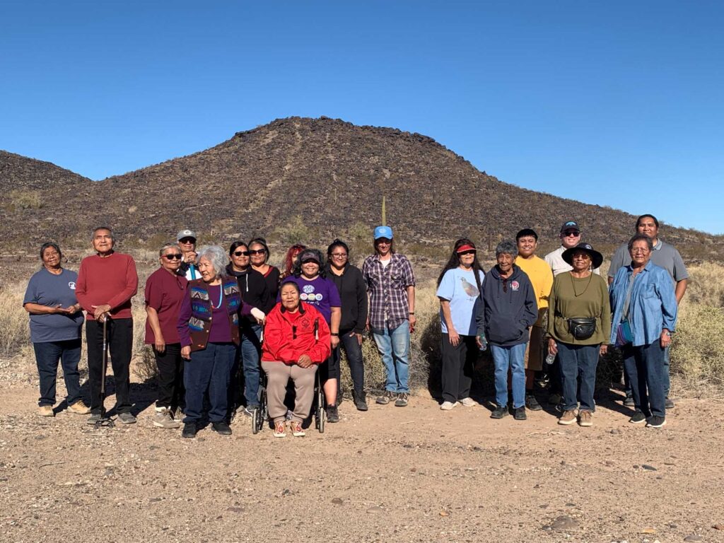
On November 9, Preservation Anthropologist Aaron Wright, Archaeology Southwest CEO Steve Nash, and I had the privilege of spending a day in the Great Bend of the Gila with YPIT and YAN community members.
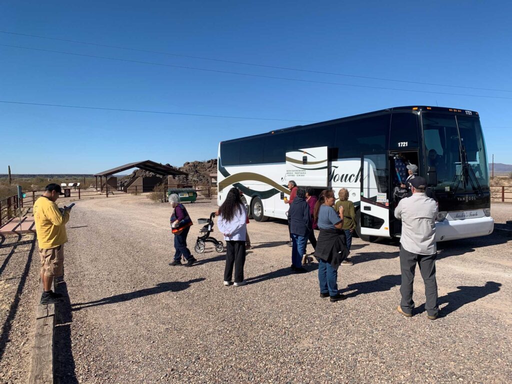
Our day began with a meetup in the town of Gila Bend. From there, we visited the Painted Rock Petroglyph Site and Campground. This important landmark is a central location in the proposed Great Bend of the Gila National Monument. It is also one of the few sites with facilities and amenities for visitors. Importantly, there is also signage and fences to help guide the public to visit the site in a respectful manner so as not to further damage the fragile petroglyphs that adorn the outcropping of granitic rock. The site is located adjacent to the Juan Bautista de Anza and Butterfield Overland National Historic Trails, which in this part of the desert follow ancient Indigenous trails laid down much earlier. This part of the desert is also where Patayan and Hohokam archaeological traditions converge. So, although the site is small in size, it is a very important part of the Great Bend of the Gila’s story.
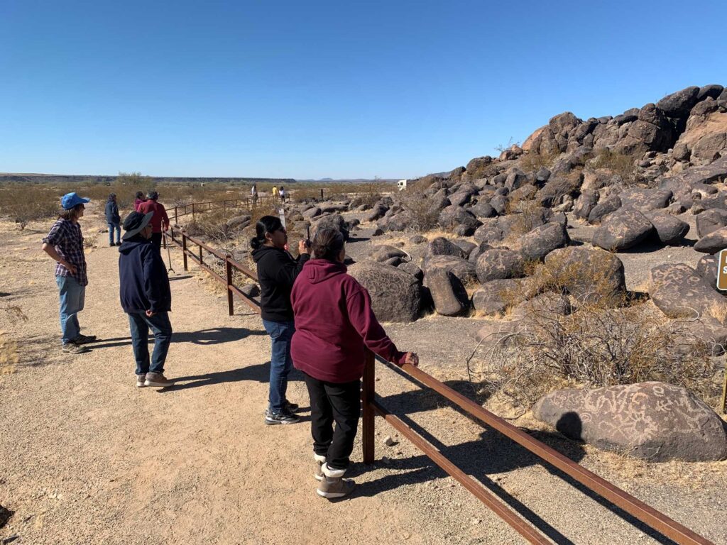
It was awesome to see everyone learn the site’s history and take in the thousands of petroglyphs on the boulders. The site is also very accommodating to visitors because it has a nice ramada with tables where, after our exploration of the site, everyone shared a meal. It was a great opportunity for the group to bond before heading to our next stop.
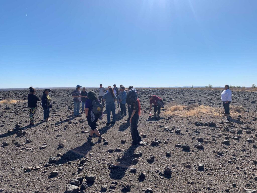
After a short drive, we all took a leisurely walk across a volcanic mesa that hosts its own crisscrossing network of Indigenous trails. It is also a place where geoglyphs—also known as ground figures—sit atop the desert pavement landscape. Here and there, if you look carefully, you will begin to discern the human-made geoglyphs from natural formations on the mesa.
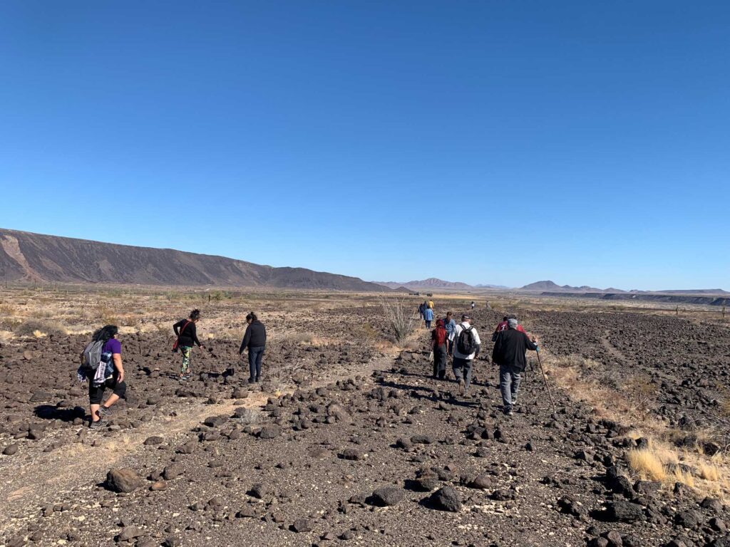
These trails always make me think about how people traveled long ago. Long before the introduction of horses and wheeled forms of transport, people walked vast distances across a part of the desert that easily reaches over 100 degrees in the summer. It can be hard to get a good idea of how extensive these trail systems are, but thanks to other modern technologies like drones, we can get a bird’s eye view of the trails and see how far they extend.
The trails also underscore the importance of the Gila River in this part of the desert. Today, with rare exceptions, the Gila no longer flows below the San Carlos Reservoir in the highlands of southeast Arizona. Occasionally, if the region has a good winter and a strong monsoon season, reservoirs on the Gila and Salt will release water and the rivers will run. Prior to the dams, the Gila was a perennial river that not only allowed for extensive agriculture, but also provided an important source of water for travelers. Whenever I see clusters of pottery sherds on the ground surface here, I wonder whether someone in the past dropped a water-carrying vessel and cursed their misfortune!
On our way back to the vehicles, I came across a Saguaro with an old nest built into one of the crooks of its arms. It reminded me that this area is also a vital habitat for our animal and plant relatives—yet another reason to protect this beautifully rugged portion of desert.
From the mesa we made our way to our last stop. Some of you may be familiar with how people created petroglyphs, and if you aren’t, I’ll do my best to explain. As I mentioned, this part of the desert is a volcanic landscape. Geologically speaking, this area is a young landscape with most of its volcanic activity occurring within the past few million years. Over great lengths of time the igneous rock develops what is sometimes called “desert varnish” and also “patina.” As this patina develops on the rock, it turns the rock from a light gray color to a dark brown or black.
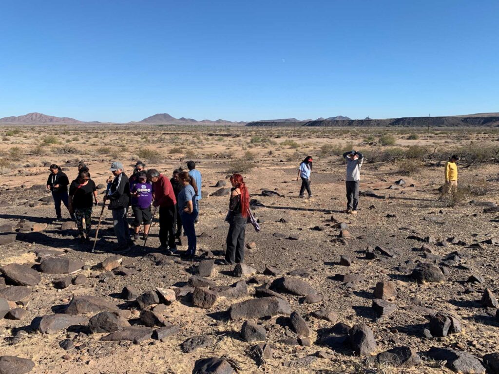
Together, the rock and the patina can be thought of as the “canvas” for a person to lay down a petroglyph. Through direct percussion, meaning using another rock to strike the boulder or cliff face, the patina is removed and the lighter-color rock beneath is revealed. Through dedication and with enough time a person can create a design that will be what we today call “petroglyphs.” (I refrain from using the term “rock art,” as we have learned from Indigenous Peoples that these rock images are much more than “art” and hold significant meaning among Tribes today.) Over time, the patina will redevelop on the petroglyphs. This allows a person documenting the petroglyphs to get a rough idea of which petroglyphs were put down prior to others—in general, the darker a petroglyph is, the older it is.
Our last stop was home to some of the darkest petroglyphs in the area. So dark that even someone who is adept at discerning petroglyphs can very easily walk past them without noticing. This spot always blows my mind, as it demonstrates that the Great Bend of the Gila has been called home by Indigenous Peoples since time immemorial.
I want to end by thanking the Yavapai-Prescott Indian Tribe and the Yavapai-Apache Nation’s Tribal Members for sharing their time, energy, and knowledge with us. Thank you! As people prepared to head home, they asked, “When can we do this again?” We said, “Soon!” I know I speak for my colleagues when I say it would be our honor to do so.
