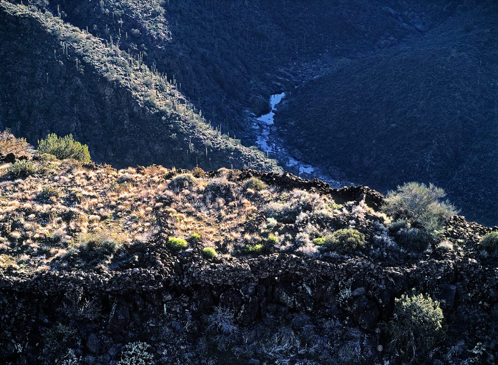
Fort above Canyon Stream
Perry Mesa and Squaw Creek, Agua Fria National Monument, Arizona, 2001 | 43 x 53.5 x 1.75 | $1,950
A 14th century prehistoric fort on the edge of Perry Mesa in the Agua Fria National Monument overlooks the depths of the canyon holding Squaw Creek below. The 71,000-acre monument in Yavapai County, Arizona protects more than 450 archaeological sites.
When I’m down on the river or up in the mountains, when I’m at a spring—I’m there for the birds. But you also realize that for hundreds of years, the spring there attracted wildlife, so it must have attracted people. So when you walk you realize you are in the footsteps of those before you.
—Tom Wood, naturalist and director of the Southeastern Arizona Bird Observatory
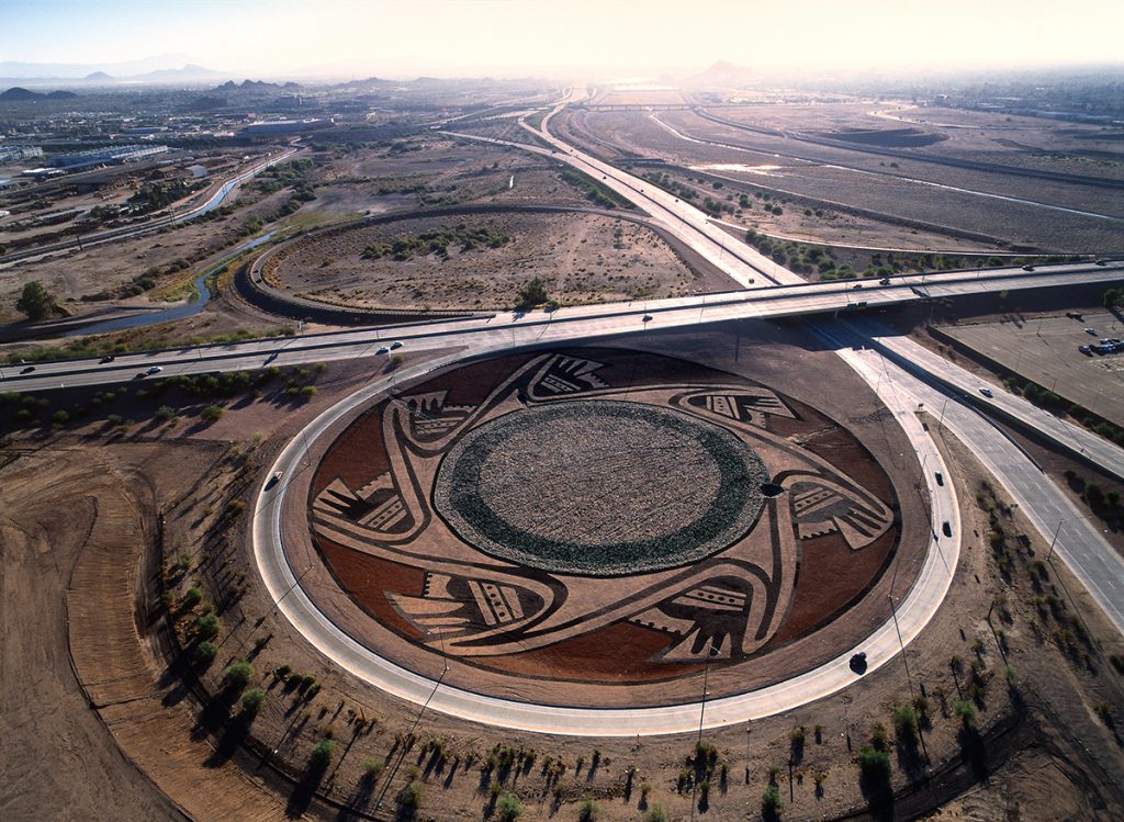
Highway Interchange with Channelized River
Expressway and Sky Harbor Boulevard, Salt River, Phoenix, Arizona, 2002 | 53 x 65.5 x 1.75 | $2,800
This circular road provides a high-speed interchange between the Hohokam Expressway (left-right) and Sky Harbor Boulevard (at right). This view is to the east, with the thin thread of water in the Salt River visible at upper right.
Today when we get on the freeway, we want to get from point A to point B as fast as we can. It’s really pathetic that people don’t even look at the landscape, with their cell phones as if they are the president…Before people had that relation with the landscape. They knew exactly where every arroyo was, because they had to know it. When it rained, people were aware. People knew in order to survive in such a harsh landscape. You couldn’t go to a drugstore and find things there. Everybody had that innate knowledge about the landscape, that memory of the landscape.
—Juan Estevan Arellano
journalist and descendent of sixteenth-century Spanish settlers of Embudo, New Mexico
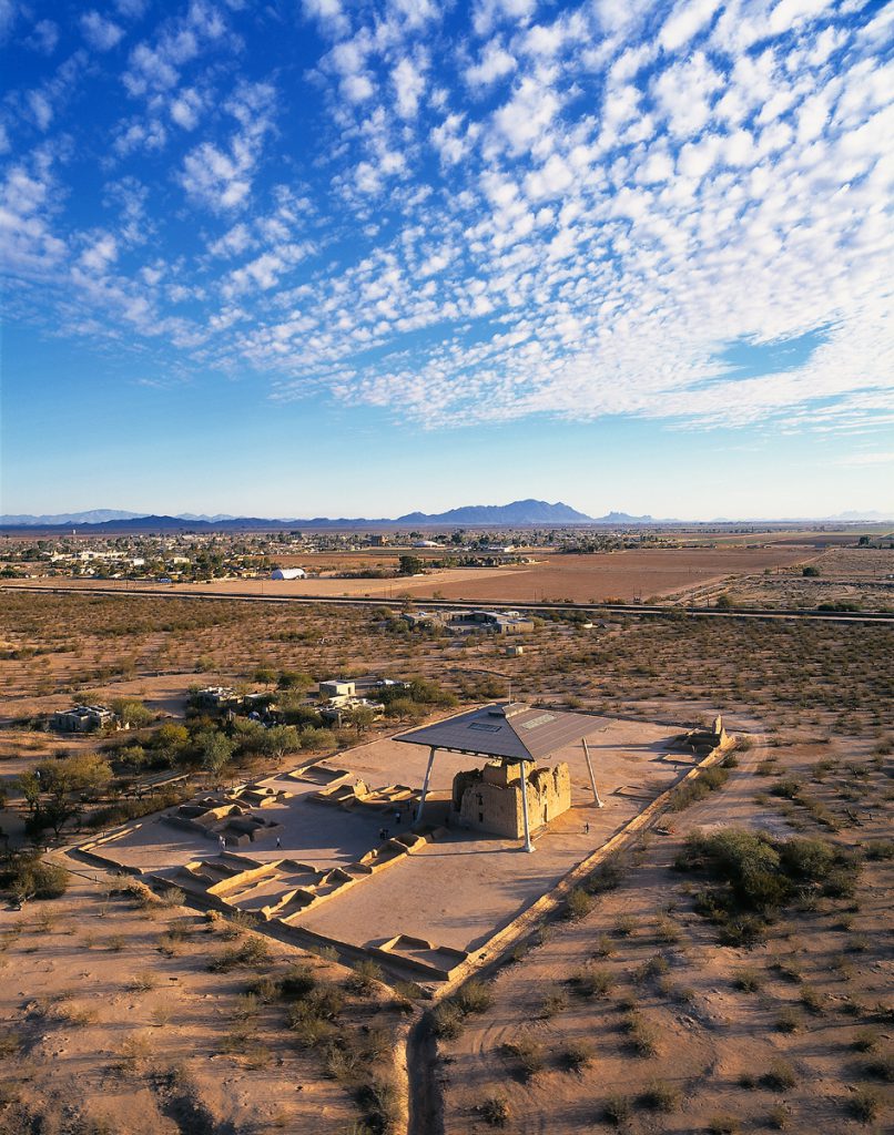
Hohokam Compound with Protective Canopy
Casa Grande Ruins National Monument, Coolidge, Arizona, 1998 | 55.5 x 65.5 x 1.75 | $2,800
Less than two miles from the Gila River, Casa Grande was located within the Hohokam heartland—an extensive prehistoric agricultural society focused upon canal irrigation in the desert. The Casa Grande Ruins National Monument was established in 1892 as the nation’s first archaeological preserve. This low aerial view is to the south-southeast, with the Picacho Mountains on the horizon.
To me, I think archaeology is almost like a type of psychotherapy for mankind. It is more than preserving the past, and we would like to learn from the past, but I think most of us have forgotten who we are and where we come from. So archaeology could at least help out by redefining who we are, where we come from, and what are our roots, and possibly give us some answers.
—Rein Vanderpot, archaeologist
Statistical Research, Inc.
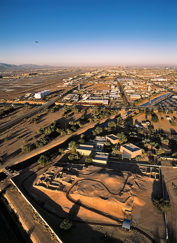
Hohokam Platform Mound with Departing Airliner
Pueblo Grande Museum, Phoenix, Arizona, 2002 | 43 x 53.5 x 1.75 | $1,950
Tucked in amid the hustle and bustle of modern Phoenix, the Hohokam site of Pueblo Grande is protected and interpreted by the City of Phoenix Parks and Recreation Department. The Phoenix basin was a major Hohokam population center 600 years ago, but more recent population growth in the valley has obliterated most evidence of prehistoric settlements.
Intaglio with Circular Footpath
Bouse Fisherman, Plomosa Mountains, Arizona, 2000 | 53 x 65.5 x 1.75 | $2,800
The Fisherman Intaglio. This prehistoric earth figure depicts a fisherman suspending a spear over a wavy line, with two fish figures below and a sun and serpent to the upper right and left, respectively. It is located in the foothills of the Plomosa Mountains about 25 miles east of the Colorado River. On BLM land, the site is fenced for protection.
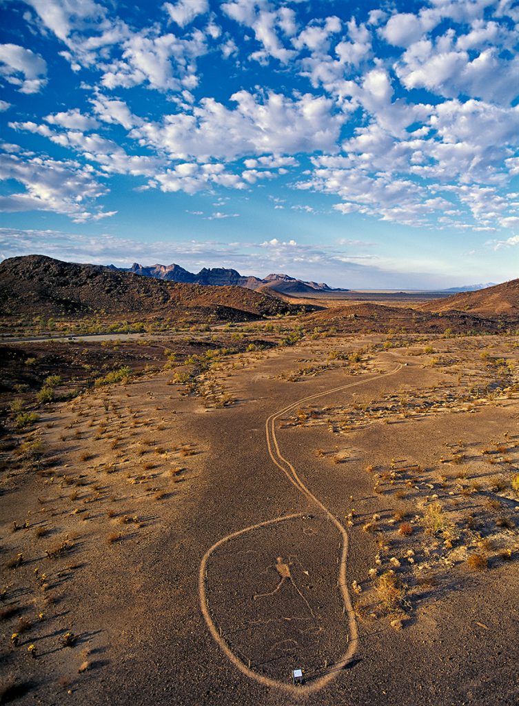
And if these places no longer speak to people they will disappear because we won’t value them. We keep what we value.
—Stephanie Dubois, superintendent
Chaco Culture National Historical Park
Pueblo Ruin with Square Kiva
Sherwood Ranch, Little Colorado River Valley, Springerville, Arizona, 2001 | 43 x 53.5 x 1.75 | $1,950
Sherwood Ranch Pueblo lies in the Little Colorado River Valley between Springerville and St. Johns, Arizona. At 300 rooms, it is the largest Pueblo IV period ruin of its kind in this region, and was inhabited until at least AD 1370. The Sherwood family donated this site to the Archaeological Conservancy in 2002. This low overhead view clearly shows the room blocks and the square great kiva.
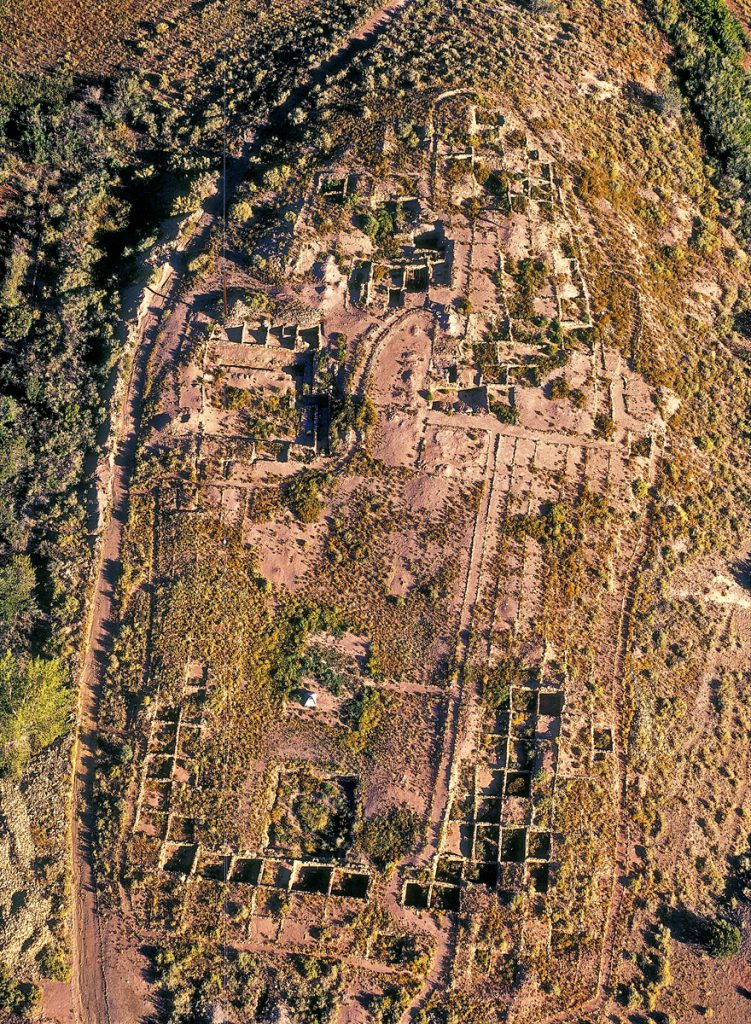
I think there is a lot of archaeologists who say these ruins have been abandoned, but they’re not because we still have the same spiritual ties to those places as our ancestors did. Compared to the Whites, like a church, it’s just abandoned, but for us, a shrine, even if it’s not been recently used, we still leave something that renews our ties to the place…So we keep ties—they’re still mentioned in songs and stories. We want them protected for that.
—Octavius Seowtewa
Zuni cultural advisor
Ruins on Cuesta
Fortaleza, Gila River Valley, Tohono O’odham Indian Reservation, San Lucy District, Arizona, 1997 | 45 x 53.5 x 1.75 | $1,950
These Hohokam ruins were partially reconstructed after their excavation in the 1960s. Located north of Gila Bend, the site overlooks the Gila River floodplain, which is now in the normally dry Painted Rocks Reservoir. In this view to the east-southeast at sunset, the sandy river bottom is visible along the top of the frame.
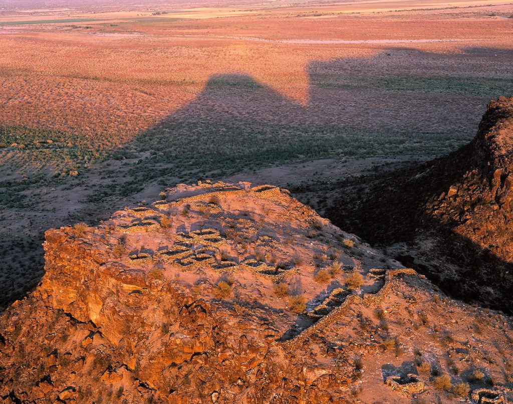
When I myself saw this place for the first time, I realized that these are not just stories, but they are history.
—Bernard Siquieros, Tohono O’odham tribal member describing his reaction after first visiting a place long spoken of in traditional stories.
Saguaros in Cemetery
Fort McDowell Indian Reservation, Arizona, 1999 | 55.5 x 65.5 x 1.75 | $2,800
A twin-column saguaro cactus stands among carefully tended graves in a community cemetery on the Fort McDowell Indian Reservation, northeast of Phoenix, Arizona.
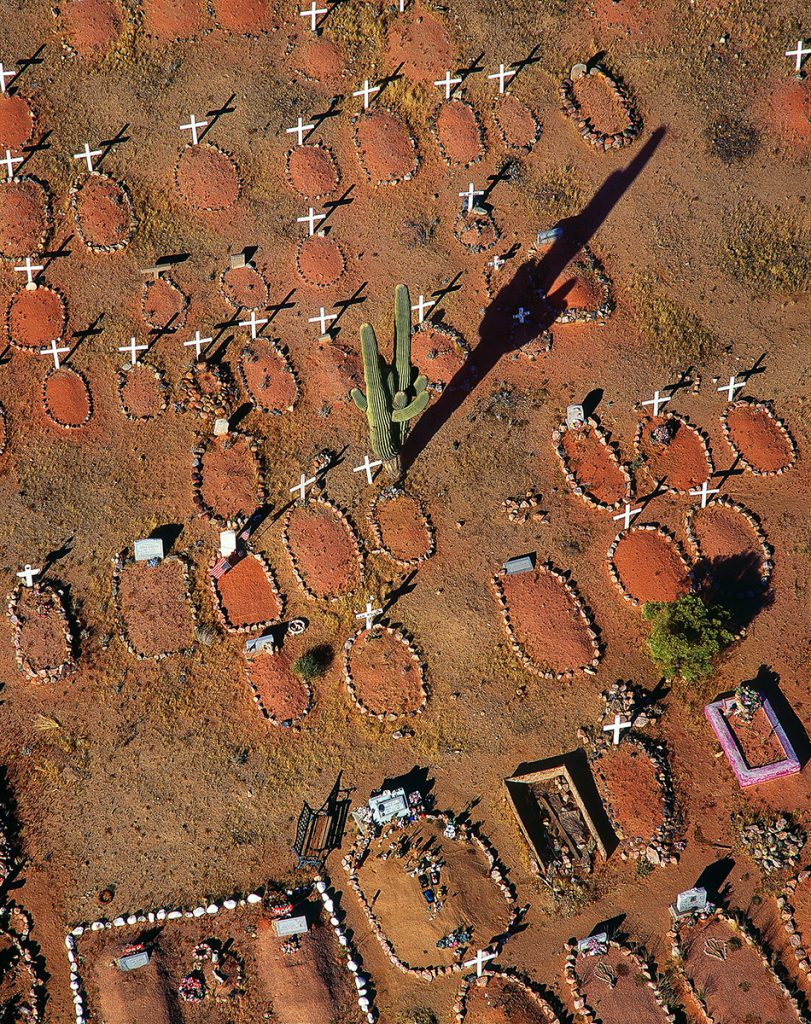
We were all created by the Creator, I’itoi. We all came from the same place, and we went out with different languages. So we were taught a respect for all native peoples. We were all created on this land, this earth. The respect we feel for the O’odham is extended to all people. If their ancestors are disturbed, then we care about that.
—Bernard Siquieros
Tohono O’odham tribal member
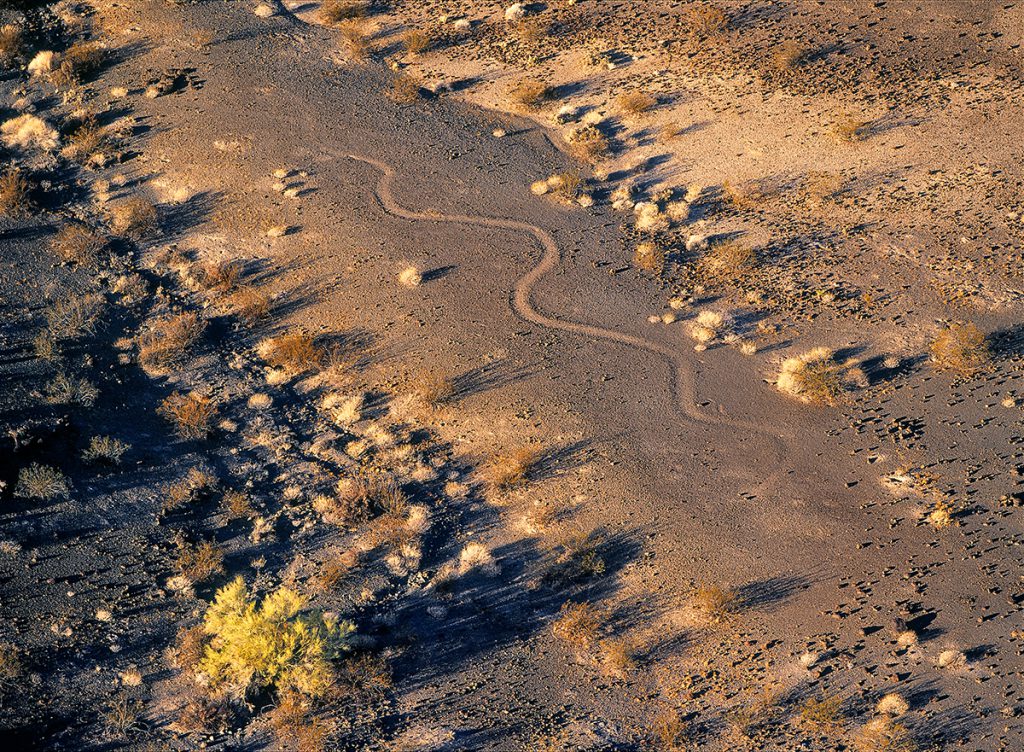
Serpent Intaglio with Palo Verde
Parker, Arizona, 2000 | 43 x 53.5 x 1.75 | $1,950
This geoglyph in the desert pavement near Parker in western Arizona is of unknown origin. Note the twin rocks placed for the snake’s eyes.
I once asked a friend what is important, and he said, “beauty.” He was dying. He was in a sleep, a slumber, and he woke up for five minutes. That was the only question I could think to ask him. Boy, was that profound for me. To be in search of beauty: what else can you be in search of, except for that? And you find beauty in the landscape. You find beauty in your natural environment. That is where wisdom comes from. That is where art comes from. That is where aesthetics come from. That is where understanding things like intimacy, industry, respect, come from. Landscape is a great teacher.
—Tessie Naranjo
Santa Clara tribal member
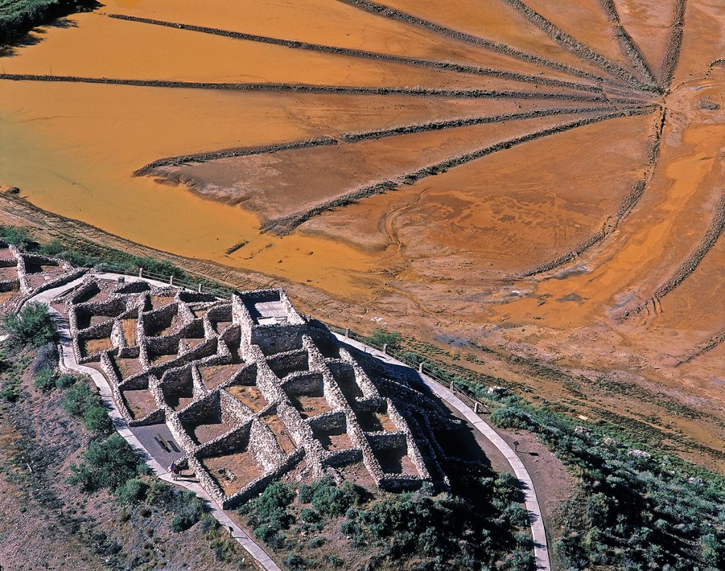
Sinagua Village with Tailings Pond
Tuzigoot National Monument, Verde River Valley, Arizona, 1998 | 55.5 x 65.5 x 1.75 | $2,800
Tuzigoot National Monument protects this hilltop Sinagua pueblo ruin in the Verde River Valley near Clarkdale, Arizona. This site was reconstructed by the National Park Service in the 1930s. The multi-story pueblo was built and occupied from AD 1000 to 1400. A tailings pond from a nearby copper mine forms the backdrop in this low aerial view.
The past is every bit as gnarly, layered, complex, difficult, ambiguous, paradoxical as the present.
—William deBuys, environmental historian and professor, College of Santa Fe
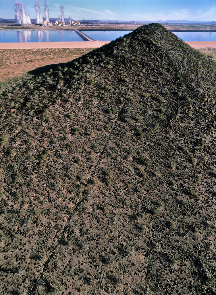
Summit Pathway with Nuclear Power Plant
Palo Verde Hills, Wintersburg, Arizona, 2003 | 43 x 53.5 x 1.75 | $1,950
A narrow clearing of rocks, called a summit pathway, extends from the base to near the summit of a volcanic hill in the Sonoran Desert west of Phoenix, Arizona. This pathway is believed to be an archaeological feature; others similar to it are fairly common in the Palo Verde Hills just north of the Gila River west of its confluence with the Salt River. The Palo Verde Nuclear Generating Station is situated among these widely scattered hills, and is visible at upper left in this low aerial view to the north.
The people who lived here long ago…didn’t have as much power as modern man to impose themselves on the landscape…What changed was…technology—now we can do what we want, when we want. The cultural and natural resources used to be very connected. Now we are less connected because technological powers allow us to ignore where we are.
—Patricia Gerrodette, president
Huachuca Audubon Society