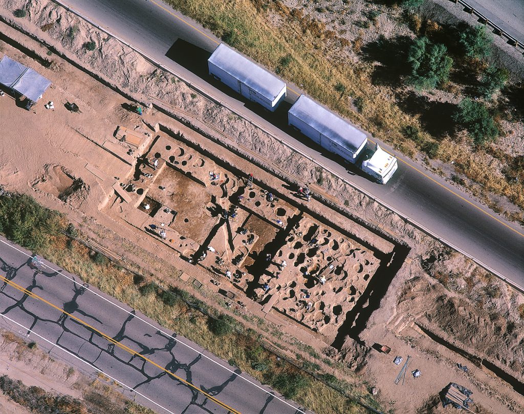
Active Excavation with Passing Tractor-trailer
Interstate 10, Tucson, Arizona, 1998 | 55.5 x 65.5 x 1.75 | NOT FOR SALE
Archaeologists excavate the Early Agricultural site of Las Capas while modern vehicle traffic continues around them. Some of the oldest known irrigation canals, dating to 1200 through 1100 BC, were found at this site. This location is being prepared for the expansion of an entrance ramp to Interstate 10 on the northwest side of Tucson, Arizona.
For me, archaeology—the discipline, the study of the past—is a means to an end. For me it is a path. I believe that there are answers in the past, personally in terms of past lives as well as for all of humankind. There are things we have lost in the past, though not forever. They are there still. They are just lost. It is about the way we look for them. Archaeology is one way. Spirituality is another way we look for them.
—Jane Pike Childress, archaeologist
Bureau of Land Management
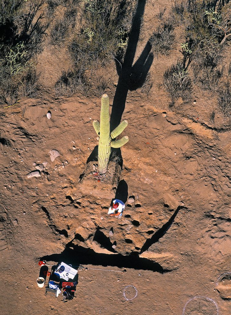
Archaeologist and Saguaro in Excavated Pithouse
Tortolita Mountains, Arizona, 2001 | 43 x 53.5 x 1.75 | $1,950
An archaeologist studies a prehistoric pithouse around a lone saguaro preserved during excavation at the foot of the Tortolita Mountains in advance of resort development.
As a result of working in a region for a number of years and very intensely, I feel like I bond with that landscape, even if it is not mine through direct ancestry. So I think archaeologists are really emotional and attached to landscapes that they work in.
—James Bayman, assistant professor of anthropology
University of Hawaii at Manoa
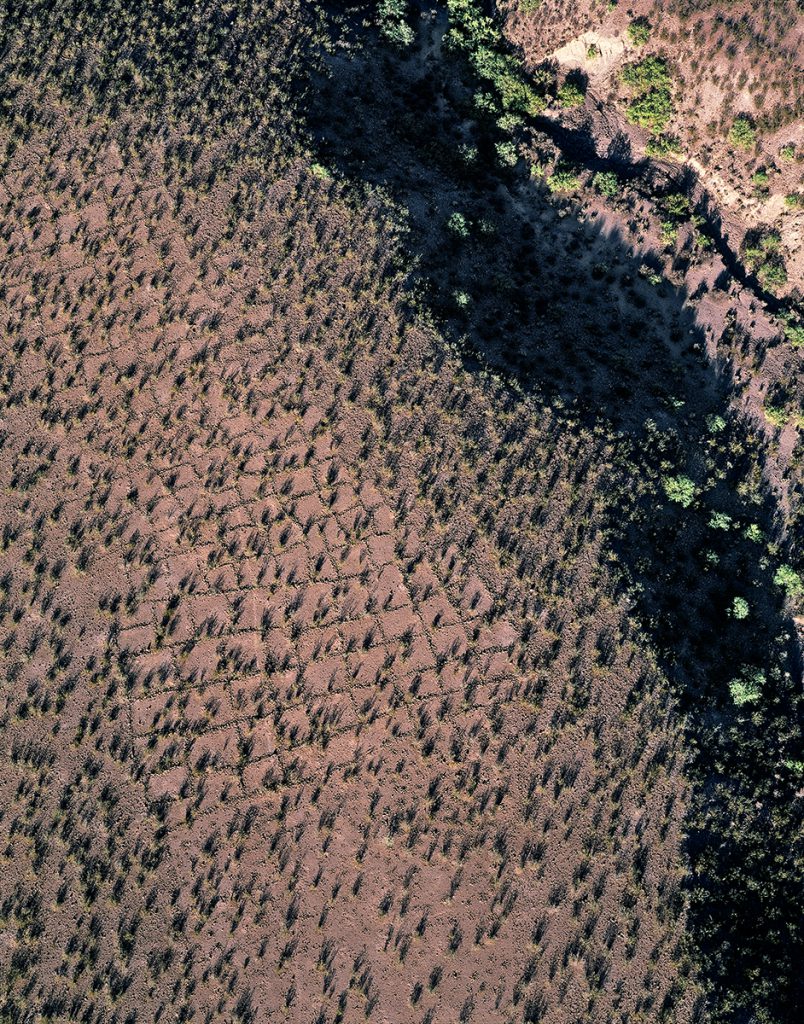
Gridded Gardens above Desert Wash
Gila River Valley, Safford, Arizona, 1997 | 45 x 53.5 x 1.75 | $1,950
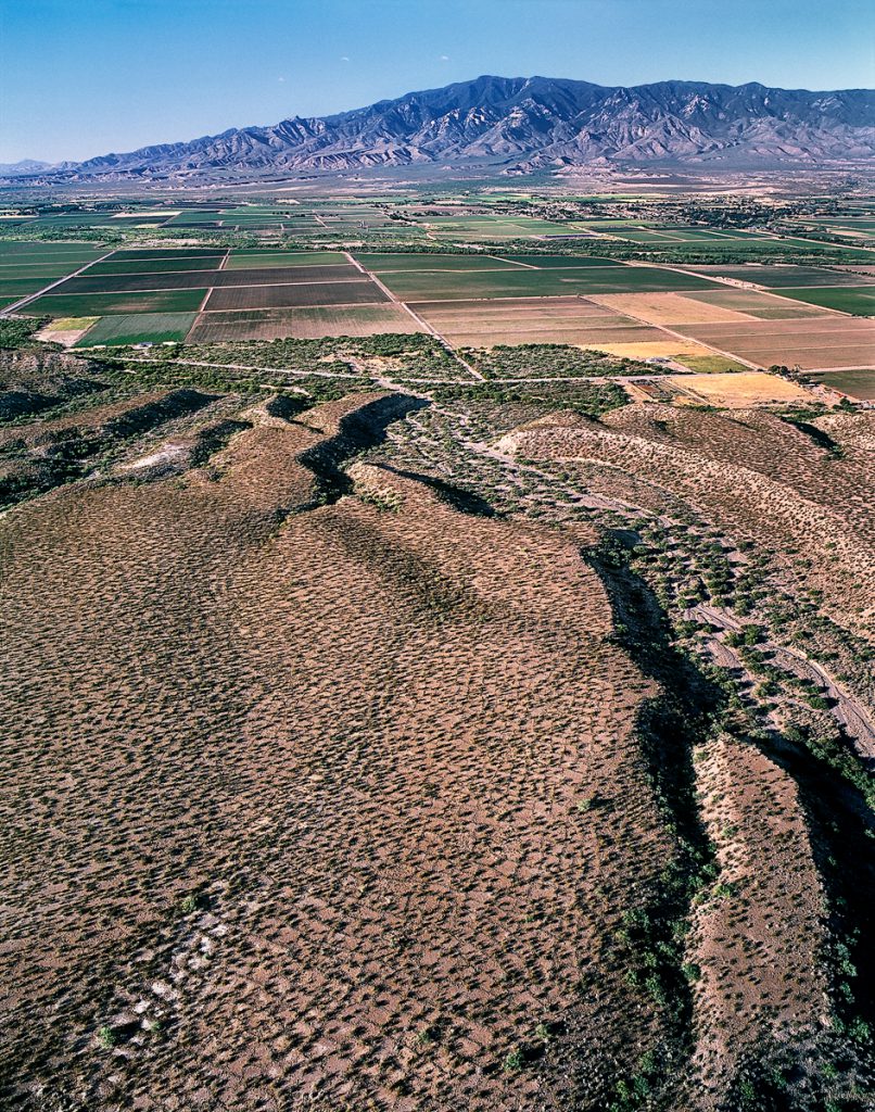
Gridded Gardens above Modern Farmland
Gila River Valley and Mount Graham, Safford, Arizona, 1997 | 55.5 x 65.5 x 1.75 | $2,800
Gridded gardens illustrate the prehistoric dry-farming technique of building low stone walls to retain water—both within the grids and under the rocks themselves. These extensive features lie just above the floodplain of the Gila River northwest of Safford, Arizona. This view is to the south, across the Gila River valley and toward Mount Graham on the horizon.
What is the future of the valley? When I’m feeling negative the answer is forty-acre ranchettes and lots of people. Lots and lots of people. And I can get real emotional about that…and when I’m feeling positive I think that maybe we’ll get our act together out here and appreciate what ranching and agriculture does, and maybe have some kind of sensible planning.
—Kali Holtschlag, rancher
Texas Canyon, Arizona
Prehistoric Ballcourt above Farmland
San Pedro River Valley, Redington, Arizona, 2000 | 53 x 65.5 x 1.75 | NOT FOR SALE
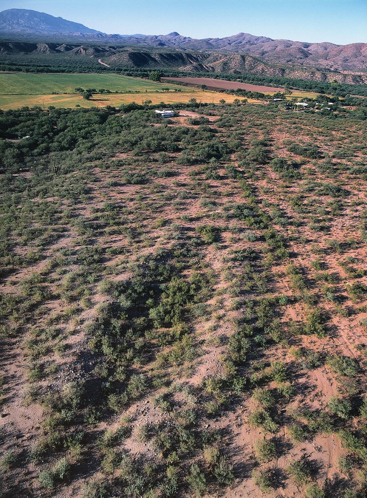
Remains of a prehistoric ballcourt near Redington, Arizona, along the San Pedro River. This site dates to between AD 800 and 1050. View is to the southwest toward Redington Pass, with the Rincon Mountains on the left horizon.
Prehistoric Terraces on Hillside with Towers
Tumamoc Hill and Downtown Tucson, Arizona, 2001 | 43 x 53.5 x 1.75 | $1,950
Low aerial view of downtown Tucson, Arizona, across the summit of Tumamoc Hill in late afternoon. This hill is a well-known landmark close to the city where traces of its prehistoric past endure. Rock walls encircle the summit below the radio towers. This trincheras site probably dates to between AD 200 and 600. Tumamoc Hill is a National Historic Landmark.
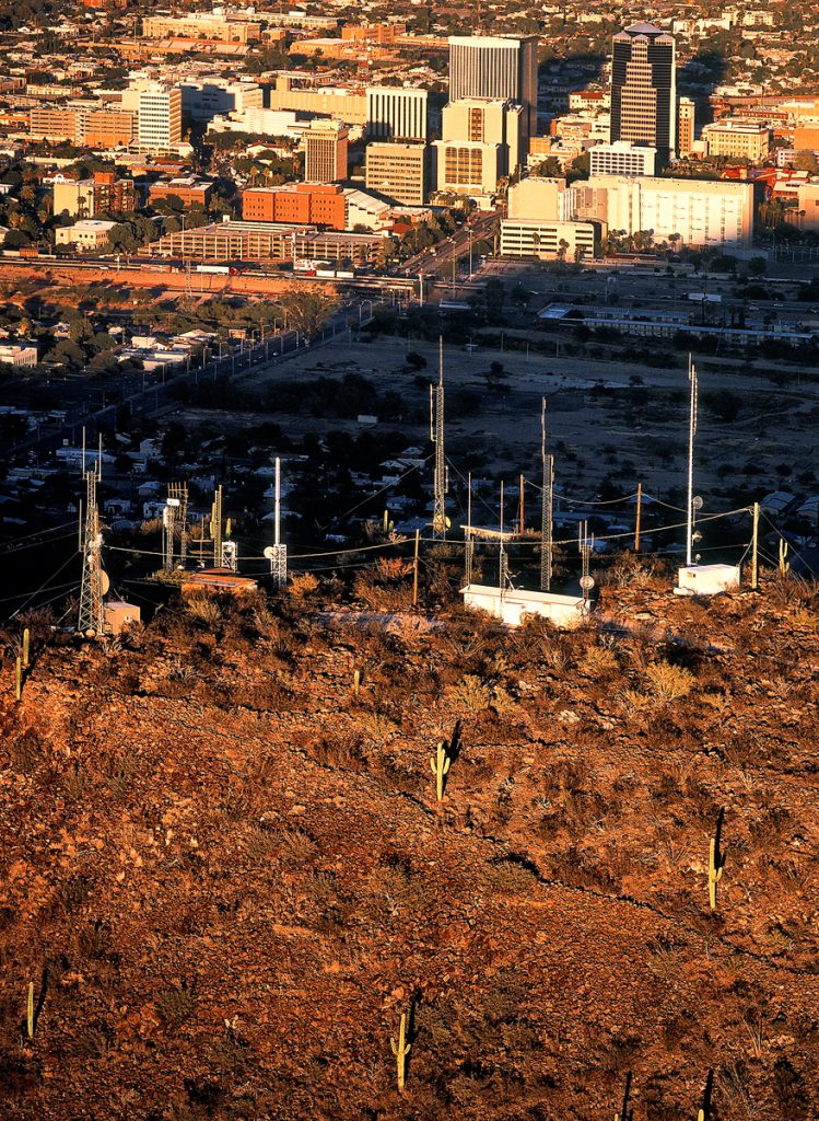
I don’t think there are enough words that I can say today to convey how solemn our concern is for Tumamoc Hill.
—Barnaby Lewis, of the Gila River Indian Community. Said during a meeting about replacing a portion of a gas line that runs along the backside of Tumamoc Hill.
Ruin Site on Bluff along River
High Mesa Ruin, San Pedro River and Galiuro Mountains, Arizona, 2000 | 43 x 53.5 x 1.75 | $1,950
Dry bed of the San Pedro River winds past the site of High Mesa Ruin, occupied from AD 1200 to 1400. The site’s bluff top location and a guard wall along the eastern edge of the site suggest its inhabitants were concerned with defensibility. View is to the east, up Kielberg Canyon to the Galiuro Mountains on the horizon.
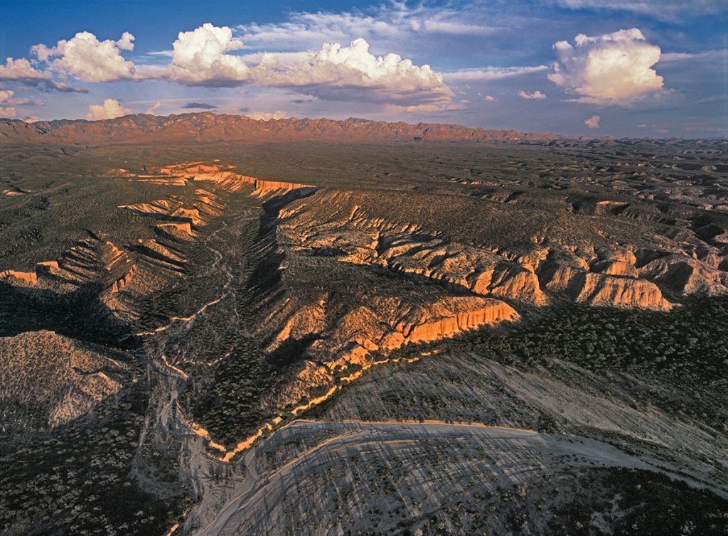
At a site like this, my heart is open—air is flowing through it, and there is no burden.
—Leroy Lewis, Hopi advisor, describing his feelings at an ancestral site in southern Arizona
Ruins on Cliff above River Valley
Reeve Ruin, San Pedro River Valley, Arizona, 2003 | 43 x 53.5 x 1.75 | $1,950
Reeve Ruin is located on the relatively flat area in the foreground of this image. Settled by immigrants from the Fours Corners region of the Southwest in the late 1200s, the steep cliffs, deep side canyons, and construction of double walls to restrict access made Reeve a highly defensible settlement.
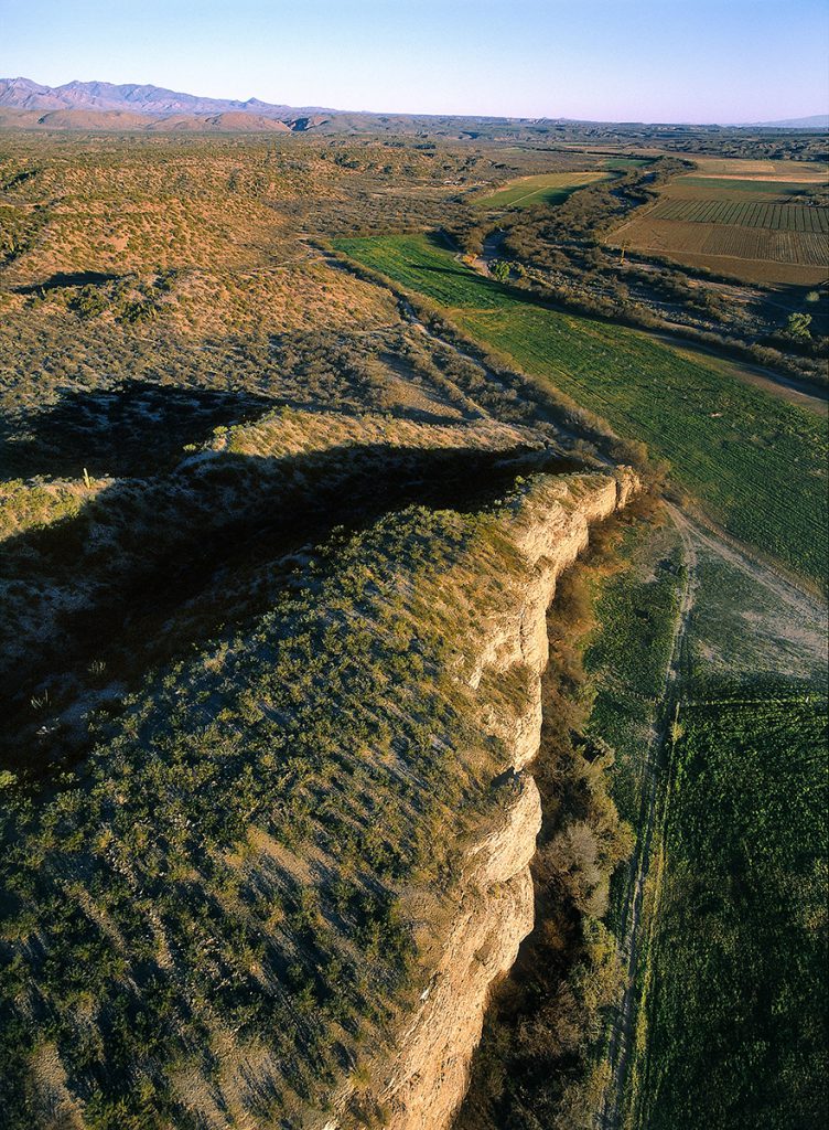
These aren’t just old ruins—it’s the history of our migrations, and how our ancestors traveled.
—Dalton Taylor, Hopi elder
Songoopavi, Arizona