Explore additional content related to Just What Is cyberSW? The Potential of Massive Databases for Future Preservation Archaeology Research, Joshua Watts’s April 6, 2021 Archaeology Café Online presentation.
Extended Q&A with Joshua Watts
Q: Do the obsidian data generally complement the ceramic-networks data or suggest circulation systems operating independently? If this is not known, what tools would be used to investigate the question?
A: My understanding—and this is drifting away from my focus on the database and tools, more into the actual research you can do with cyberSW—is that the ceramic and obsidian distribution networks are organized differently. But right now I couldn’t tell you exactly how they are different. I think it would be really interesting to explore this… and I think cyberSW would be a good tool to start digging into the question. We can build similarity adjacency matrices from decorated ceramics or sourced obsidian assemblages and build social networks from those matrices. And then look at the centrality and betweenness stats from those networks to describe differences more concretely. Somebody should do this.
Q: What an extraordinary bundle of opportunities, and a great presentation, Josh. How difficult would it be to find the two sites dating to, say 1300, that are the most similar to one another but are located the farthest away?
A: I think we could do something… similar… to what you are asking, but we might have to jump out of cyberSW and use some GIS tools to finish the job. Now you’re giving me ideas on features we need to add to the web app!
So, specifically: We can select sites based on the date range that people were probably living at the site, e.g, 1300, like you said, or better yet a range like 1275–1325 or similar. We can then use our similarity metrics for ceramic or obsidian assemblages (or both) to put together a big table of just how similar those sites are. What we can’t do (YET!) is to compare those results to the same “similarity” or actually distance matrix you would get from comparing how far away sites are. Currently you would need to do that in a GIS—though I could see adding that to cyberSW without much difficulty at this point. As an aside, I would love to see this even a step more sophisticated, using least-cost-paths instead of straight-line distances. Hmmmm…
Extended Content:
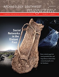
Read Archaeology Southwest Magazine (Vol. 27, No. 2), “Social Networks in the Distant Past,” available as a free PDF download, here.

Visit and explore the cyberSW database here.
See also:
- Chacoan Archaeology at the 21st Century Vol. 32, Nos. 3 & 4
- Project Page: cyberSW
- Project Page: The Heritage Southwest Database
- Blog Post: Introducing cyberSW
- Press Release: Grant Award from NEH Funds Tribal Petroglyphs Team
- Video: How Migration Transformed Social Networks in the Late Prehispanic Southwest
To stay informed about future online presentations and video releases, join our email list below:
Sign up for emails
