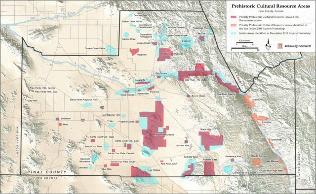
Regional planning is an essential element of comprehensive archaeological management programs. The sheer number of cultural resources and associated landscapes at risk will always outstrip the time and money required to fully meet preservation needs. Thus, it is necessary to develop strategies for setting priorities to decide how to best spend limited resources to protect rare and irreplaceable elements of our cultural heritage. This document briefly outlines an approach to cultural resource priority setting, loosely analogous to biodiversity conservation planning, recently employed by Archaeology Southwest and partners (Laurenzi et al. 2013). The cultural resource priority setting process is not intended to substitute for, or replace, requirements under federal, state, tribal, or municipal law with respect to cultural resource management, but is meant to complement such efforts.
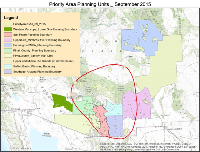
The overarching goal of this planning process is to develop a platform for systematically identifying, describing, and evaluating places in need of protection (i.e., priority areas) using site-specific cultural resource data and expert knowledge. The delineation of cultural resource priority areas serves a number of purposes, including facilitating Archaeology Southwest’s ongoing engagement with local, state, and federal partners and private land owners in developing site- and landscape-scale protection actions (e.g., site purchases, preservation easements, etc.). Priority area designations are also devised to help meet the needs of land managers by providing spatially explicit information on cultural resources that can assist with early phases of large scale projects (i.e., energy development, energy transmission, etc.). These data can be used to provide regionally contextualized assessments or justification for new preservation designations, such as National Monuments, or administrative designations, such as the Bureau of Land Management’s Areas of Critical Environmental Concern (ACEC). Importantly, this priority setting process also has the potential to help land managers address recent calls by the U.S. Department of the Interior (Jewell 2014) for the development of landscape-scale management and mitigation procedures. Cultural resource priority setting moves beyond site-specific assessments (such as NRHP eligibility) and provides landscape-scale perspectives on the relative importance of cultural resources.
Methods
The cultural resource priority setting process can be divided into five basic steps: 1) data acquisition/organization, 2) soliciting expert knowledge, 3) land ownership research, 4) condition assessments, and 5) finalizing priority area boundaries and descriptions. Each of these five steps is described below with reference to recent planning efforts by Archaeology Southwest.
Data Acquisition/Organization
The first step in the priority setting process is to gather and organize the relevant cultural resource data for the planning area. The planning area is often defined geographically (such as a watershed, or a political subdivision such as a County), thematically (extent of Mimbres cultural tradition), or based on current management concerns (Agency planning unit). The data compiled for past Archaeology Southwest planning efforts include site information from all relevant state archaeological databases (e.g., AZSITE, NMCRIS, Compass, IMACS), as well as from management databases developed by specific state or federal agencies (e.g., BLM, Forest Service, NPS, etc.). In addition to these management-focused site databases, we also compile information from relevant research databases. One of the primary resources included in this category is the Heritage Southwest (HSW) database housed at Archaeology Southwest. This database contains detailed information on various resource classes (i.e., major habitations, public architecture, rock art) across the Southwest.
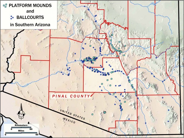
Once the relevant data are compiled, the next step is to organize them in a way that allows for systematic assessment of the frequency and spatial distribution of different categories of sites. We sort these data into categories using all available contextual and feature information (often requiring reevaluations of the primary data), focusing in particular on categories of sites that are considered especially significant. These focal sites, as we call them, are defined based on the presence of certain key features, such as public architecture, concentrations of habitation structures, concentrations of petroglyphs or pictographs, importance to descendant communities, or other noteworthy features. The list provided here is not exhaustive, and we define our focal-site criteria for each planning effort in consultation with local experts. In addition to these archaeological data, we also gather other supplementary information that has already identified sites/areas of significance, such as those sites on the National Register of Historic Places, existing cultural resource parks (e.g., Bandelier National Monument), or administrative designations designed to better protect cultural resources (e.g., Sears Point Area of Critical Environmental Concern).
Soliciting Expert Knowledge
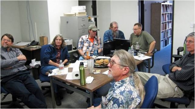
The experts invited to participate in planning efforts for a given area are selected to include relevant land managers, tribal representatives, and researchers with detailed knowledge of particular areas or kinds of resources (drawn from suggestions from other invitees and surveys of recent regional literature). Whether in a workshop setting or one-on-one, we provide the geospatial information described above (along with relevant base maps) to our experts and work with them to draw polygons (in real time) around areas of particular concern. When defining these initial polygons, we ask expert participants to consider the scientific value, integrity, representativeness, and rarity of individual resources in the context of the study area as a whole. We argue that priority should be given to site complexes or settlement clusters in which sites can be related in time, culture, or space. In certain ways, these are cultural resource “hotspots” where opportunities to learn about the past are greatest. Importantly, the focus on “hotspots” provides an opportunity to consider the distribution of less-visible categories of sites (such as lithic or sherd scatters), providing opportunities to ensure the preservation of a broader suite of related cultural resource classes. This begins to move us closer to concepts such as cultural landscapes that are nonetheless bounded in space and can allow for the efficient use of available resources. After initial priority designations are drawn, we work with our expert contributors to provide information on the reasoning behind each designation in terms of the criteria described above: scientific value, integrity, representativeness, and rarity. This process allows us to link expert knowledge to empirical data on the distribution of archaeological resources.
Land Ownership Research
After initial priority area designations have been made, we conduct additional detailed research focused on identifying land ownership boundaries and additional information on sites within and nearby (within 1 mile) of priority areas. This process includes accessing original site records and other available published resources on the sites in question and confirming site locations. This more-detailed spatial information, where available, provides for fine-grained boundary delineation based upon the presence of sites that could be reasonably related spatially, temporally, and/or culturally to the focal sites “captured” in the expert-defined polygons. In some instances, areas originally defined as distinct in the experts’ discussions are combined into one Priority Area or split into smaller units. Land ownership within expert-defined polygons is then reviewed and boundaries are further adjusted to more efficiently conform to ownership interests. In general, we seek to minimize the inclusion of private property by excluding private lands that do not include focal sites. In a similar vein, tribal lands may be excluded from the analysis based on the sovereign concerns of tribal governments.
Condition Assessments
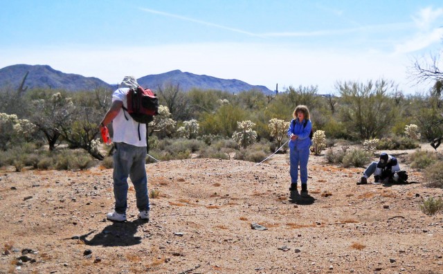
In some instances, the information we have on focal sites/resources within expert-defined polygons is old, and possibly outdated. In cases where available information is greater than 20 years old, or in cases where a change in the status of a particular area is likely, we will conduct additional research to update information on the integrity of focal resources. Where possible, we conduct in-field assessments of site condition using a volunteer crew with substantial field experience and/or Archaeology Southwest staff (including students in our Preservation Archaeology Field School program). On private lands, this requires the explicit permission of landowners. Where we discover that the integrity of a potential focal resource has been compromised, it is not unusual for us to remove the priority area from further consideration. Where on-the-ground efforts are not possible, we use readily available aerial imagery (e.g., Google Earth, USGS) as another source of information to supplement site condition assessments.
Finalizing Priority Area Boundaries and Descriptions
Once all of the procedures outlined above are complete, we add any new information available into our priority area descriptions and finalize the boundaries based on new information obtained through condition assessments and/or land ownership research. These data are then placed into a master relational database (as an ArcGIS File Geodatabase), which is further linked to information on the specific focal sites within each priority area and landownership contact information. These final priority area designations and descriptions are then archived and provided to approved parties upon request, including interested land managers.
Outcomes
The priority area designations described here help to guide other important preservation activities in several ways. First, the information gathered through these planning exercises informs our interactions with local landowners and highlights opportunities for specific site-protection actions, such as site purchases and/or the creation of preservation easements. Priority planning also provides a basis for our work with local, state, national, and tribal governments to advocate for the protection of important cultural resources, such as the creation or expansion of National Monuments or other special designations. Beyond the work we do at Archaeology Southwest, the results of these priority planning exercises provide information useful to land managers working with governmental agencies to decide how to best allocate resources toward the protection of cultural resources (such as creating new land designations or travel management plans on public lands). Finally, we argue that our priority area designations provide information essential for understanding the effects of various alternatives for large-scale undertakings (such as energy development projects, transmission lines, roads, etc.) for cultural resources prior to the selection of specific alternatives. Our priority areas are already being used in the early stages of several such projects, including the Bureau of Land Management, Southline Transmission Project.
For more information and examples of past planning efforts:
Laurenzi, Andy, Matthew A. Peeples, and William H. Doelle (2013), “Cultural Resources Priority Area Planning in Sub-Mogollon Arizona,” Advances in Archaeological Practice 1(2):67–76. (Opens as a PDF.) This article explains the priority planning process and the reasoning behind our approach in more detail.
Click here to read about cultural resource priority area planning focused on precontact cultural resources in Pinal County, Arizona (opens as a PDF).
Click here to read about cultural resource priority area planning in the San Pedro valley of southeastern Arizona (opens as a PDF).