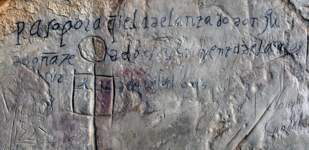
An imposing sandstone bluff along an ancient east–west trail through western New Mexico represents an important part of the history and heritage of the Southwest. The shape of this bluff created a large natural plunge pool, or tinaja, that provides the only reliable source of water for many miles. The location has served travelers for at least the past 2,000 years. Many left their marks or carved inscriptions in the soft Zuni Sandstone that makes up the steep cliff walls, hence the English name “Inscription Rock.”
The Spaniards called this place El Morro—the promontory. These cliffs were known for their ancient inscriptions well before the arrival of the conquistadores, however. Zuni peoples called this place A’ts’ina, which translates as “the place of inscriptions.” Ancestors of the Zuni built an 800-room pueblo village on top of the bluff; it is still called A’ts’ina today.
Ancient Americans, Spanish Colonial conquistadores and missionaries, and wayfarers of the American Territorial period all left inscriptions and carvings at this special place. Today, this amazing collection is protected as part of El Morro National Monument.
Unfortunately, the Zuni Sandstone is subject to a wide variety of natural and cultural processes that are taking a toll on the historic and ancient inscriptions. In 2006, through the Cooperative Ecosystems Study Unit, the National Park Service and Archaeology Southwest initiated a research project to evaluate the use of three-dimensional laser scanning to monitor erosion on ten historical inscription panels. Each of the panels was scanned in 2006, 2007, and 2010. Comparisons of the laser scans indicate that significant erosion is taking place above the tinaja pool and along the northeast edge of Inscription Rock. Our findings also indicated that our choice of LIDAR scanners and analysis software was not ideal for this type of environmental monitoring.
Related to This
-
Location El Morro National Monument
